
I’ll start the story by saying that this route is not very easy for beginners. A lot of people go overnight. It seems that the mileage of the route is 6-7 km one way, but it goes very slowly due to the fact that there are a lot of “mysteries” on the way from the category “and how to get there?”. We just left the canyon on 2/3 of the way, went towards the road above, walked along the upper path to the cave from which the Fars River originates, and thereby greatly shortened the path. Thus, they did it in one day. They understood very well why there were so many campsites along the way, as well as traces of ATVs and horse hooves. It seems close, but not very easy.
The Fars River is the left tributary of the Laba, which in turn belongs to the Kuban River basin. The river is not small, the length is already 197 km. The upper reaches of the river are located near the village of Pobeda, which is located near the village of Kamennomostsky (Khadzhokh). These very «upper» 6 km we wanted to see. What is so special about this river? It has just an innumerable number of waterfalls. So big you’ll lose count. As well as two rather interesting caves and a large number of large and small grottoes. Along the way, you will see many interesting geological samples. They literally roll under your feet. Big and small, I want to take everything with me if they didn’t have such weight …
I took very few photos, more on video, the video will be released later. And the article is more overview than detailed. But for us traveling people, sometimes just a clue or a name is enough to create a new route.
How did you get there:
Approximately at the point 44.28681, 40.30086 there is a fork in the road leading to the village of Pobeda. This gravel road goes to the quarry. We stopped at the point that is closest to the cave from the road, the coordinates of which are indicated below.
If you do not know how to use coordinates, then you can read about it in THIS ARTICLE.
The first cave of the Fars river valley. Cave «Powder».
Coordinates: 44.28399, 40.34418
The cave is wild. Conditionally divided into two parts. One is quite gentle and easily accessible, we went down without any problems. The second is a well cave, vertical with a very wide entrance. Perhaps they are connected somewhere, we have not investigated in detail. Definitely go back with uniforms and inspect both parts carefully. Bat life is abundant in the cave.
The first part of the cave is low but long.
Entrance to the second part of the cave, well:
An interesting combination of stones and roots on the cave wall in the form of a cow’s head:
Then we just moved up the canyon against the current of the river. The maps show only the largest waterfalls, but there are many more of them if you count the small ones.
One of the waterfalls of the Fars River One of the waterfalls of the Fars River
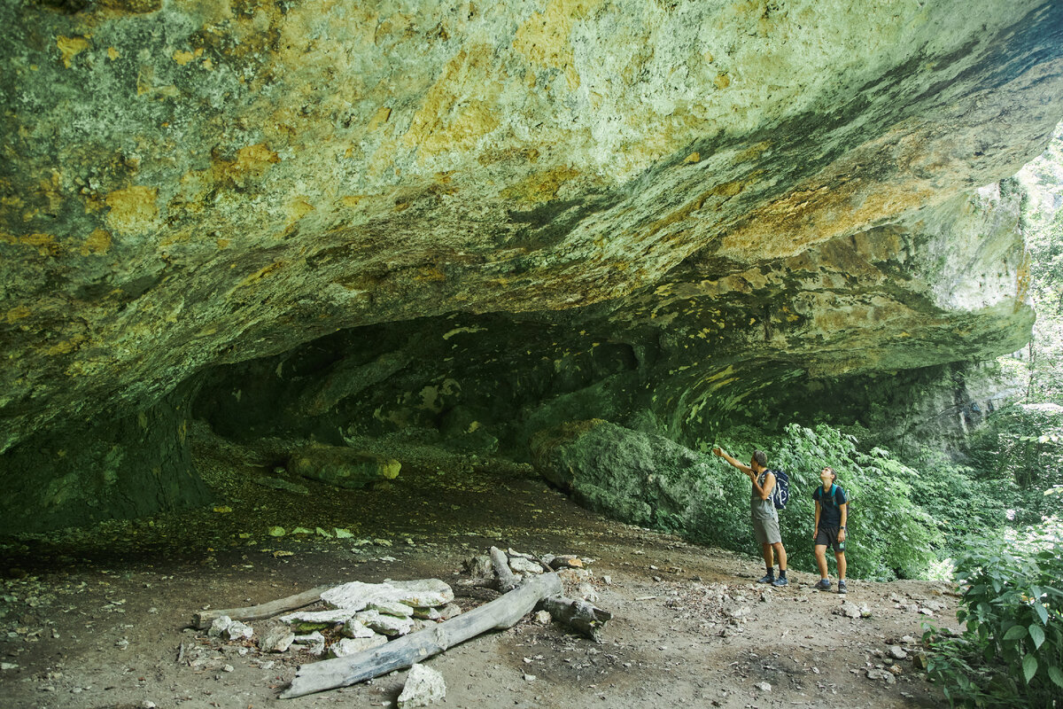
The grottoes are quite large in size, shape, geological features. They don’t pull on the caves, but they are spectacular for sure.
Many grottoes marked on the map are high and you need to make an effort to get into them. The rocks stand high and it is very beautiful.
In some grottoes there are parking lots, but not primitive, but quite modern. There, obviously, some tourists settle down for the night or take shelter from the rain.
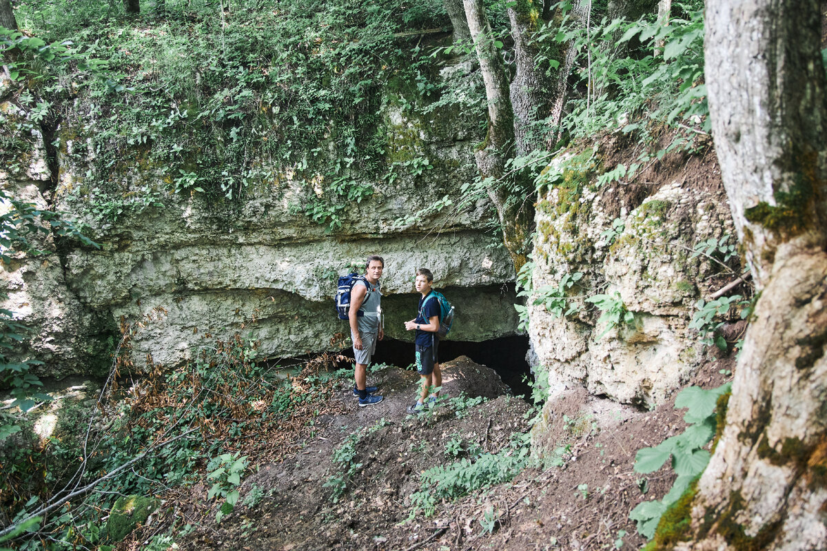
As I wrote above, after 2/3 of the way, we realized that we might not meet the deadline if we continue to move at a similar pace. We went to the road, which is located above the canyon. We walked literally «according to instruments», i.e. direction, no path. On this road we went around in the last cave. It’s called «Pass Through». If you go down this road initially, then you will miss all the beauty.
Cave «Through»
Coordinates: 44.26963, 40.37453
The cave is really through, but the exit is very small, a person cannot climb through exactly. Unless for bats, which are very numerous in the cave. When we found the cave, a rather large “flock” of these representatives of the animal world flew out at us.
The entrance is wide, the same river Fars flows along the bottom, originating in this cave. For this reason, we could not go deep into the cave. The water in the river is ankle-deep, somewhere knee-deep. The water is quite cold, you can’t go barefoot. Again, we plan to return with rubber boots. The cave resembles a mine, only of natural origin.
This is such an interesting day trip. Friends, please express your opinion about this article by commenting and liking, I will be very grateful to you! Thanks to
Read also in our Zen:
Sights of Adygea. List of interesting dzen.ru 12 unique and stunning caves in Lago-Naki dzen.ru Natural stone bridges in Adygea and a waterfall dzen.ru